
Madu River

In the Southern region of Sri Lanka lies the Galle district. Balapitiya is a little town in the district and would be quite unimportant; except for the location of a river. The Madu River is very rich in biodiversity. It passes through the wet zone of Sri Lanka opening up into the large Madu Lagoon on its way to the Indian Ocean.
The Mangroves and their Ecology – Facts
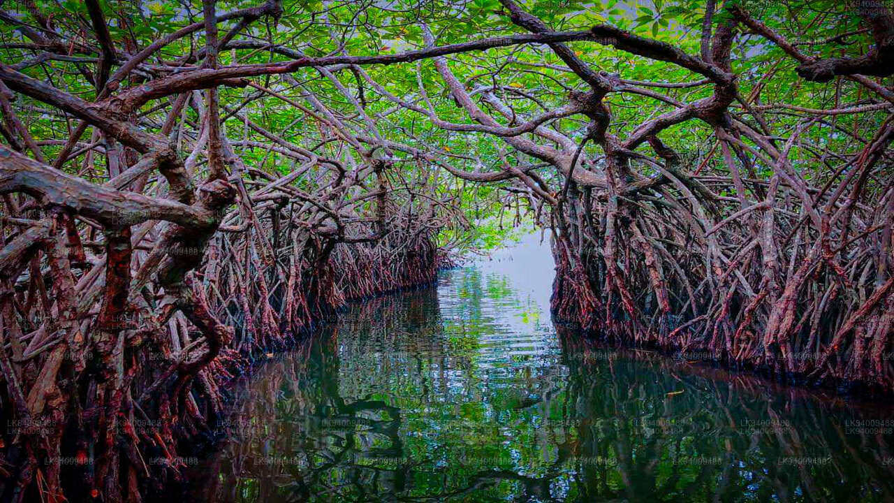
- The Madu River area surrounding the river are all swampy marshlands covered in mangrove forests.
- The forest covers over 61 hectares, that is over 150 acres. 14 of the 24 species of mangroves are found in this area.
- It is interesting to note that mangroves play a huge part in preventing erosion.
- The value of the mangroves was understood in December 2004, during the devastating tsunami, when forest acted as a natural barrier protecting the region.
- The large growths of mangrove trees have caused a chain of ecological gain. The soil protected by the mangrove trees is very fertile. This has caused a rich growth of other wetland plants.
- Over 300 species, 19 of which are endemic, have been discovered so far.
- The region continues to be a treasure trove to biologists and ecologists with many undiscovered species in the unreachable depths of the mangrove forests.
- The plantlife in turn have supported a large number of wildlife that depends on them.
- The largest animal in the region is the wild boar. There are other smaller animals such as monkeys, a variety of squirrels, etc.
- When it comes to birds, cormorants and kingfishers are a common sight. For avid bird watchers, the mangrove forests are a dream coming true. There are over 111 bird species identified to inhabit the region.
- There are 31 types of reptiles, namely snakes, lizards, and crocodiles.
- There are also over 50 kinds of butterflies and 25 kinds of mollusks found in the Madu River zone.
Situated about 80 km South of the busy commercial hub of Colombo in the fishing town of Balapitiya, the Madu River or locally referred to as the Madu Ganga is a hidden natural treasure in the Southwest coastal area of Sri Lanka. The river flows gracefully through dense mangrove forests before widening into a lake forming a wetland that is home to an estuary with many islets that is part of a large and complex coastal ecosystem. The biodiversity significance of this area is known among many nature lovers while the mangroves are home to varied amounts of flora and fauna. Due to this reason, the Madu River has been listed under the International Ramsar Convention which is an International Treaty for the conservation and sustainable use of wetlands (Ramsar Sites).
Mangroves plays a huge role in preventing soil erosion while the Madu Ganga wetlands covers an area of over 61 hectares with over 10 species of mangroves flourishing all over. The soil that is protected through the mangrove trees is very fertile and is the reason for the rich growth of other varieties of wetland plants. There are over 300 species of plants discovered so far while this marshland has become a treasure trove for biologists and ecologists to search for more. The mangrove wetlands are also filled with amphibians, birds, reptiles, butterflies, molluscs and lizards making it a perfect for photographers.
The Islands and their Charms
Other than the wetlands, the area consists of many islands. According to earliest reports, the region consisted of 64 islands while most of them seem to have sunk with time. As of now, there are only 25 islands reported while only 15 have sizable landmass. Even though some of these islands are inhabited, most are covered in forests and shrubs. One of the largest islands is home to an ancient Buddhist Temple dating back to the earliest rulers of the country. The main sources of economy in this region are the Cinnamon Industry, fishing and boat / river safaris. You even get places where you can enjoy open-air fish massages which are quite popular in many parts of the world.
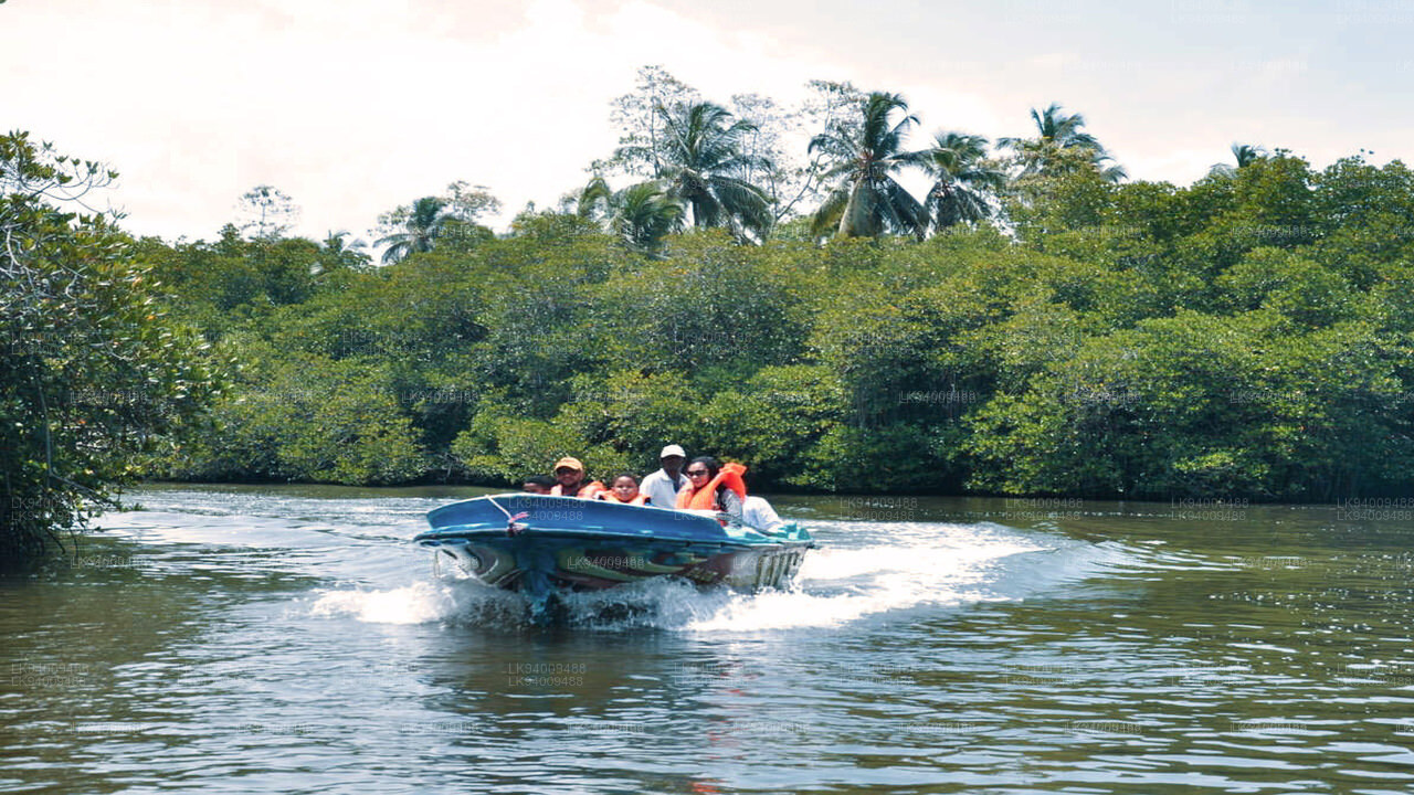
Lakpura’s Madu River Safari
Aiming all naturalists out there who are interested in biodiversity and mangroves, the Madu River Boat Safari is indeed an activity that should not be missed if you ever travel to the South of Sri Lanka. Lasting for a couple of hours, this journey allows you to explore the natural phenomenon of these wetlands winding your way through secretive passages admiring nature unfold before your eyes.


